
 Medialab-Matadero Madrid
Learning from GIS
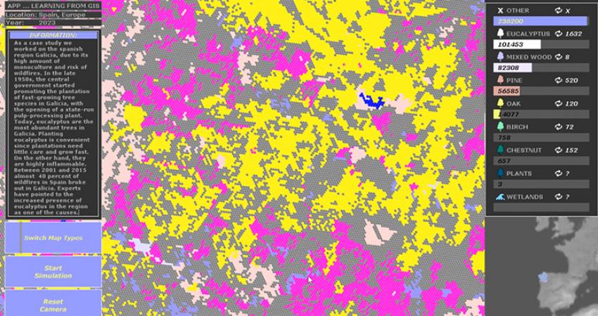
Learning from GIS aimed to develop a prototype for a map-based carbon accounting system, working with A Coruña in northern Spain as a case study. The region was analyzed based on publicly available data on land ownership, types of trees, and land use policy. An interactive map was developed, subdividing the area with a hexagonal grid. This subdivision allowed for a high-resolution analysis of the region displaying properties of each hexagonal cell, such as tree species, zoning, or if the parcel is in public ownership. The prototype was used to develop conceptual scenarios for future economic models for local communities utilizing trees as a carbon-absorbing entity, which can generate profits under the European Emissions Trading System (EU ETS). The scenarios ranged from short-term high-profit but also high-risk scenarios using fast-growing trees to more sustainable long-term scenarios based on local tree species and community-based business models.
Project team: Joaquin Lozano Suarez (GIS analysis), Johannes Schlusche (interactive design), Iván Simó Sánchez (software development), Boram Koh (research), Nicolas Stephan (project management), Marine Lemarié (project management)